Calming Measures or Displaced Traffic? Langton’s 20mph Programme Under Review
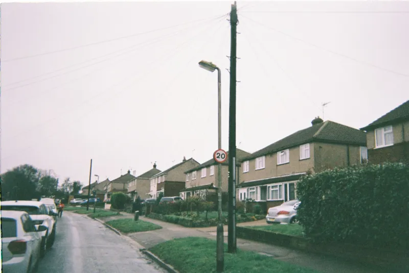
Langton Council’s environment and transport committee returned to the question of speed this month with a progress report on the council’s 2026 20mph programme. The paper is not a victory lap. It sets out where new limits are operating, where implementation has slipped, and what the council still does not know about traffic being pushed onto neighbouring roads.
At the heart of the review is a familiar local dilemma: a speed limit is easy to sign, harder to enforce and harder still to evaluate. The committee’s report, drawn together from highway officers, automatic traffic counts and police collision data, tries to answer a narrower question — whether the programme is changing driver behaviour on the streets it has reached.
Where the limits now apply
According to the committee report, the first phase of the 2026 programme covered School Lane, Mill Terrace, Orchard Close, the residential section of Station Road and the streets immediately around Langton Primary School. Phase Two added several roads on the eastern edge of the village and a cluster of terraced streets near the recreation ground. Officers say signs and road markings are in place on all Phase One streets, while Phase Two is substantially complete, with two carriageway roundels still outstanding because of resurfacing work.
Not every street on the original list made it. Hollow Way, Copperfield Road and the Long Meadow estate were deferred. Hollow Way was held back because it carries a bus route and because emergency access arrangements needed further discussion. Copperfield Road was postponed pending drainage and footway works, which officers said would have made sign installation premature. Long Meadow scored lower in the council’s priority assessment and did not have a completed consultation record by the time the programme was sequenced.
The distinction matters. A deferred street is not a rejected street, but residents on those roads have seen little more than a line in a committee paper. For them, the 20mph map of Langton remains incomplete.
The evidence: slower streets, uncertain edges
The council’s monitoring report uses before-and-after traffic counts, alongside police collision records. On treated residential streets, mean speeds fell from an average of 27mph to just under 22mph. The 85th percentile — the speed at or below which 85 per cent of vehicles travel — fell from 32mph to 26mph. Compliance improved, but it is not universal. Depending on the street, between 8 and 15 per cent of vehicles were recorded at more than 25mph.
Collision data is more encouraging but should be handled with care. Officers recorded no fatal or serious collisions on treated streets in the first nine months of 2026, compared with one serious and three slight injury collisions in a comparable earlier period. The report itself cautions that collision numbers are small, that reporting practices vary, and that a single year cannot establish causation. Lower speeds may be reducing severity; they may also be coinciding with other changes.
The more contested question is displacement. Traffic counts on Church Street and the Broadway show a modest increase at peak times, in the region of 3 to 5 per cent. Officers describe that as within normal seasonal variation, but some residents are less relaxed. Drivers who once cut through Mill Terrace or Orchard Close may now be using the main road, or finding another rat-run altogether. The council has promised further counts at three boundary roads in the new year.
School-run voices and shopfront concerns
On a damp November morning, the school run around Langton Primary tells its own story. Parents waiting at the crossing on School Lane say the lower limit has made the morning walk feel less fraught, though not always quieter.
‘It is better than it was,’ said one parent waiting with a pushchair. ‘You still get the occasional driver who treats the sign as a suggestion, but most people are slowing down. The difference is at drop-off, when there are so many cars about.’
For local businesses, the picture is mixed. A shopkeeper on Station Road said deliveries now take slightly longer, particularly for larger vehicles, but added that the change had made the frontage safer for customers. A courier driver, who asked not to be named, said satnav systems were often slower to reflect the new limits than local drivers. ‘You do what the sign says,’ he said. ‘But some of the routes are tight, and the 20mph zone does not change the width of the road.’
How residents can request or challenge a change
The council’s process for speed-limit changes is more open than many residents assume, but it is also more technical. Requests for a new 20mph zone can be made to the highways team or through a local councillor. They are assessed against criteria including collision history, recorded vehicle speeds, community support, the function of the road and the presence of schools or other vulnerable users. A petition can strengthen a case, but it does not automatically trigger a scheme.
Where a formal change is proposed, the council must advertise a Traffic Regulation Order and invite objections. Objections are considered before a final decision, and in some cases a public inquiry may be held. Residents who want to challenge an existing limit can make representations during that statutory process or ask for the street to be reviewed in a future programme. Once signs are installed, the scope for reversing a decision is narrower.
The committee paper notes that enforcement remains a police matter. The council can promote compliance through engineering, signs and education, but it cannot set up speed cameras on every residential road. Officers are exploring a targeted enforcement pilot with local police and Community Speedwatch volunteers, though no date has been fixed.
What happens next
The committee has asked officers to bring an updated report in March 2027, including fresh traffic counts on boundary roads and an assessment of the deferred streets. Until then, Langton’s 20mph programme remains a work in progress: calmer on some streets, contested on others, and still short of the comprehensive map that residents were originally promised.